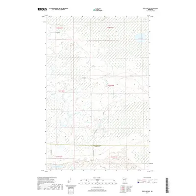
2019 Map of Deer Lake NW
USGS Topo · Published 2019About this map
Myrtle Lake and Shine Lake anchor a landscape defined by extensive wetlands and seasonal waterways in northern Minnesota. This 2019 survey documents a sparsely populated area near the Koochiching and Itasca County line, where the terrain is dominated by complex drainage systems and peatlands. The presence of Reilly Brook cutting through the center of the sheet highlights the importance of natural drainage in this low-relief region. Access through the dense woods and bogs is facilitated by a network of forest and county roads, including N Lofgrin Rd, Holstrom Rd, and S Lofgrin Forest Rd. These corridors serve as the primary infrastructure for local land management and timber access within the township-and-range divisions, providing a clear view of how modern survey lines overlay the natural hydrology of the northern woods.
Find a feature on this map
17 named features on this map. Tap any name to fly to it.
Don’t see what you’re looking for? This feature index may not catch every label — zoom into the map to look around manually.
Map Details
Editions of this 2019 Deer Lake NW Map
This is the sole edition of this map. No revisions or reprints were ever made.
Other maps of this area

1919 · M
USGS Topo · 1:62,500

1954 · Hibbing
USGS Topo · 1:250,000

1954 · International Falls
USGS Topo · 1:250,000

1957 · Hibbing
USGS Topo · 1:250,000

1957 · International Falls
USGS Topo · 1:250,000

1958 · International Falls
USGS Topo · 1:250,000

1958 · Hibbing
USGS Topo · 1:250,000

1964 · Hibbing
USGS Topo · 1:250,000

1970 · Johnson Landing SE
USGS Topo · 1:24,000

1970 · Nett Lake River SE
USGS Topo · 1:24,000