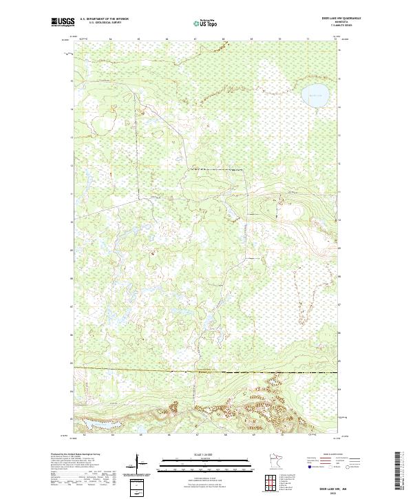
2022 Map of Deer Lake NW
USGS Topo · Published 2022About this map
The Koochiching Co Itasca Co boundary line bisects this northern Minnesota landscape, where the terrain is dominated by extensive wetlands and drainage systems. Myrtle Lake and Shine Lake serve as the primary water bodies in a region otherwise characterized by the winding path of Reilly Brook. The road network is sparse, relying on local connectors like N Lofgrin Rd and Holstrum Rd to navigate the low-lying reaches of the North Woods. The presence of S Lofgrin Forest Rd indicates the managed nature of these timberlands, while the intricate survey of section lines across townships like t63n r24w reflects the foundational mapping of the state's wilderness. This modern survey captures the persistence of the natural hydrology and the established county-maintained infrastructure including Co Rd 525 near the southern border.
Find a feature on this map
17 named features on this map. Tap any name to fly to it.
Don’t see what you’re looking for? This feature index may not catch every label — zoom into the map to look around manually.
Map Details
Editions of this 2022 Deer Lake NW Map
This is the sole edition of this map. No revisions or reprints were ever made.
Other maps of this area

1919 · M
USGS Topo · 1:62,500

1954 · Hibbing
USGS Topo · 1:250,000

1954 · International Falls
USGS Topo · 1:250,000

1957 · Hibbing
USGS Topo · 1:250,000

1957 · International Falls
USGS Topo · 1:250,000

1958 · International Falls
USGS Topo · 1:250,000

1958 · Hibbing
USGS Topo · 1:250,000

1964 · Hibbing
USGS Topo · 1:250,000

1970 · Johnson Landing SE
USGS Topo · 1:24,000

1970 · Nett Lake River SE
USGS Topo · 1:24,000