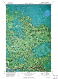
1970 Map of Deer Lake NW
USGS Topo · Published 1973About this map
Koochiching State Forest dominates this northern Minnesota landscape, captured during a 1970 survey. This orthophotomap provides a rare hybrid view of the region, overlaying topographic data onto high-altitude aerial photography taken in 1969. The imagery reveals the dense vegetation and wetland patterns surrounding Myrtle Lake and the smaller Shine Lake to the south. Human activity in this timber-heavy environment is evidenced by a network of seasonal routes, including the Winter Trail and the Holstrum Spur. The southern portion of the map transitions into the George Washington State Forest, where a Lookout Tower stands as a focal point for forestry management and fire watch. This specific format highlights the exact timber stands and clearings as they existed just before the turn of the decade, providing an unusually clear record of the forest's composition.
Find a feature on this map
11 named features on this map. Tap any name to fly to it.
Don’t see what you’re looking for? This feature index may not catch every label — zoom into the map to look around manually.
Map Details
Editions of this 1970 Deer Lake NW Map
This is the sole edition of this map. No revisions or reprints were ever made.
Other maps of this area

1919 · M
USGS Topo · 1:62,500

1954 · Hibbing
USGS Topo · 1:250,000

1954 · International Falls
USGS Topo · 1:250,000

1957 · Hibbing
USGS Topo · 1:250,000

1957 · International Falls
USGS Topo · 1:250,000

1958 · International Falls
USGS Topo · 1:250,000

1958 · Hibbing
USGS Topo · 1:250,000

1964 · Hibbing
USGS Topo · 1:250,000

1970 · Johnson Landing SE
USGS Topo · 1:24,000

1970 · Nett Lake River SE
USGS Topo · 1:24,000