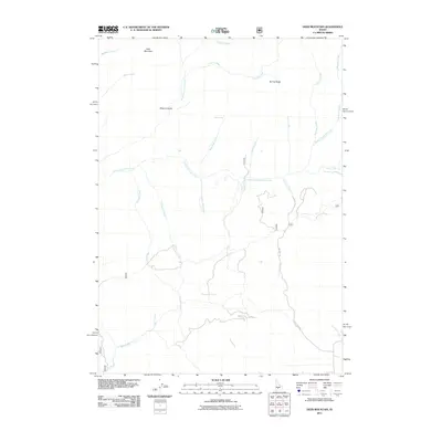
2011 Map of Deer Mountain
USGS Topo · Published 2011About this map
Deer Mountain and its surrounding drainage systems define this high-altitude landscape in Elmore County as documented in the early twenty-first century. The area is dominated by the complex hydrology of the Middle Fork Lime Creek and South Fork Lime Creek, which receive seasonal runoff from features like Spring Ridge and Browns Gulch. This period shows a largely unpopulated wilderness, with infrastructure limited primarily to Lime Creek Rd and a network of minor access roads winding through the southern terrain. Water sources such as Cold Spring and named tributaries like Hole-In-Wall Creek and Roanhide Creek provide essential markers for understanding the natural movement through this territory. The geography reflects a high-country environment where narrow gulches and ridge lines dictate the paths of modern travel and historical exploration alike.
Find a feature on this map
24 named features on this map. Tap any name to fly to it.
Don’t see what you’re looking for? This feature index may not catch every label — zoom into the map to look around manually.
Map Details
Editions of this 2011 Deer Mountain Map
This is the sole edition of this map. No revisions or reprints were ever made.
Other maps of this area

1892 · Camas Prairie
USGS Topo · 1:125,000

1893 · Camas Prairie
USGS Topo · 1:125,000

1894 · Rocky Bar
USGS Topo · 1:125,000

1900 · Sawtooth
USGS Topo · 1:125,000

1955 · Hailey
USGS Topo · 1:250,000

1957 · Fairfield
USGS Topo · 1:62,500

1959 · Hailey
USGS Topo · 1:250,000

1962 · Hailey
USGS Topo · 1:250,000

1963 · High Prairie
USGS Topo · 1:24,000

1963 · Deer Mountain
USGS Topo · 1:24,000