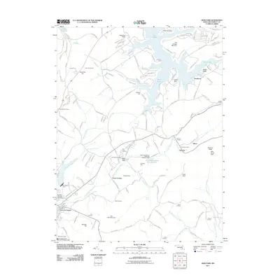
2011 Map of Deer Park
USGS Topo · Published 2011About this map
Deer Park and Loch Lynn Heights serve as central hubs in this landscape, where the Little Youghiogheny River winds through the valley floor. The area is defined by its series of ridges and knobs, including Hoop Pole Ridge, Garrett Hill, and The Little Mountain. To the north, the fingers of Deep Creek lake reach into the terrain at Turkey Neck and Beckman Point. Significant water management is evident through several structures, such as the Little Youghiogheny River Site Number 7 Dam, which created the Little Youghiogheny River Reservoir. Genealogists will find a high density of family and community burial grounds, from the Georges Cemetery in the east to the Wonderly Cemetery near Bittinger Hill. These sites, along with smaller settlements like Altamont and Wilson, reflect a long history of rural residence and local industry.
Find a feature on this map
122 named features on this map. Tap any name to fly to it.
Don’t see what you’re looking for? This feature index may not catch every label — zoom into the map to look around manually.
Map Details
Editions of this 2011 Deer Park Map
This is the sole edition of this map. No revisions or reprints were ever made.
Other maps of this area

1895 · Piedmont
USGS Topo · 1:125,000

1899 · Grantsville
USGS Topo · 1:62,500

1899 · Oakland
USGS Topo · 1:62,500

1900 · Accident
USGS Topo · 1:62,500

1900 · Oakland
USGS Topo · 1:62,500

1904 · Grantsville
USGS Topo · 1:62,500

1919 · Elk Garden
USGS Topo · 1:48,000

1920 · Elk Garden
USGS Topo · 1:48,000

1922 · Elk Garden
USGS Topo · 1:62,500
1947 · Sang Run
USGS Topo · 1:24,000