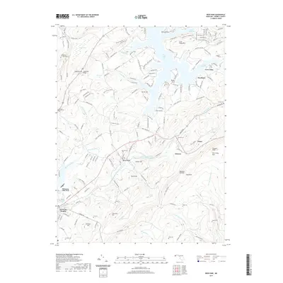
2019 Map of Deer Park
USGS Topo · Published 2019About this map
Deer Park and the neighboring settlements of Mountain Lake Park and Loch Lynn Heights anchor this 2019 survey of the Maryland highlands. The landscape is defined by the steep rises of Backbone Mountain and Hoop Pole Ridge, with the headwaters of the Little Youghiogheny River carving through the valley floor. Genealogists will find a high concentration of family and community burial grounds throughout the rural outskirts, including Paughs Cem, Upole Cem, and the Ferndale Baptist Cem.
Find a feature on this map
174 named features on this map. Tap any name to fly to it.
Don’t see what you’re looking for? This feature index may not catch every label — zoom into the map to look around manually.
Map Details
Editions of this 2019 Deer Park Map
This is the sole edition of this map. No revisions or reprints were ever made.
Other maps of this area

1895 · Piedmont
USGS Topo · 1:125,000

1899 · Grantsville
USGS Topo · 1:62,500

1899 · Oakland
USGS Topo · 1:62,500

1900 · Accident
USGS Topo · 1:62,500

1900 · Oakland
USGS Topo · 1:62,500

1904 · Grantsville
USGS Topo · 1:62,500

1919 · Elk Garden
USGS Topo · 1:48,000

1920 · Elk Garden
USGS Topo · 1:48,000

1922 · Elk Garden
USGS Topo · 1:62,500
1947 · Sang Run
USGS Topo · 1:24,000