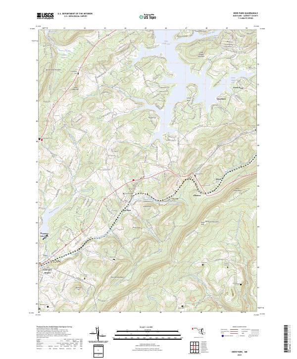
2023 Map of Deer Park
USGS Topo · Published 2023About this map
Deer Park and the neighboring community of Altamont sit atop the high plateaus of Garrett County, Maryland, where the headwaters of the Little Youghiogheny River wind through the valleys. The landscape is defined by the sharp elevations of Backbone Mountain and Hoop Pole Ridge, which frame a region historically significant for its transition between Appalachian watersheds. In the northern reaches, the southern fingers of Deep Creek Lake extend toward Turkey Neck, illustrating the recreational and hydrographic character of the area. This 2023 survey provides a detailed view of local family heritage, documenting numerous burial grounds such as Beckman Cem, Potomac Camp Cem, and Roman Nose Cem. The map traces the integration of modern infrastructure with traditional mountain geography, from the heights of Lookout Hill to the residential clusters of Mountain Lake Park and Loch Lynn Heights.
Find a feature on this map
54 named features on this map. Tap any name to fly to it.
Don’t see what you’re looking for? This feature index may not catch every label — zoom into the map to look around manually.
Map Details
Editions of this 2023 Deer Park Map
This is the sole edition of this map. No revisions or reprints were ever made.
Other maps of this area

1895 · Piedmont
USGS Topo · 1:125,000

1899 · Grantsville
USGS Topo · 1:62,500

1899 · Oakland
USGS Topo · 1:62,500

1900 · Accident
USGS Topo · 1:62,500

1900 · Oakland
USGS Topo · 1:62,500

1904 · Grantsville
USGS Topo · 1:62,500

1919 · Elk Garden
USGS Topo · 1:48,000

1920 · Elk Garden
USGS Topo · 1:48,000

1922 · Elk Garden
USGS Topo · 1:62,500
1947 · Sang Run
USGS Topo · 1:24,000