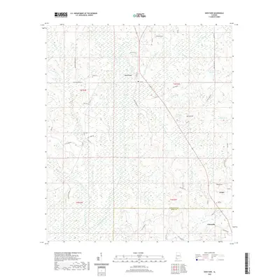
2020 Map of Deer Park
USGS Topo · Published 2020About this map
Deer Park serves as the focal point for this 2020 study of the borderlands between Washington and Mobile counties. The landscape is defined by the winding course of the Escatawpa River and its numerous tributaries, including Pond Creek and Bennett Cr. This modern survey documents the persistent rural infrastructure of southwestern Alabama, tracing a network of family-named roads such as Earl Wood Rd and Eddie Turner Rd that connect isolated settlements and historic burial grounds.
Find a feature on this map
55 named features on this map. Tap any name to fly to it.
Don’t see what you’re looking for? This feature index may not catch every label — zoom into the map to look around manually.
Map Details
Editions of this 2020 Deer Park Map
This is the sole edition of this map. No revisions or reprints were ever made.
Other maps of this area

1942 · Deer Park
USGS Topo · 1:62,500

1943 · Deer Park
USGS Topo · 1:62,500

1943 · Citronelle
USGS Topo · 1:62,500

1943 · McIntosh
USGS Topo · 1:62,500

1944 · McIntosh
USGS Topo · 1:62,500

1946 · Citronelle
USGS Topo · 1:62,500

1953 · Hattiesburg
USGS Topo · 1:250,000

1958 · Hattiesburg
USGS Topo · 1:250,000

1974 · Fruitdale
USGS Topo · 1:24,000

1974 · Vinegar Bend
USGS Topo · 1:24,000