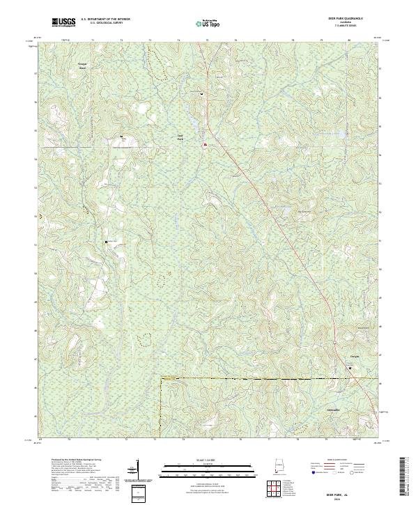
2024 Map of Deer Park
USGS Topo · Published 2024About this map
The Escatawpa River and its numerous tributaries, including Grapevine Creek, Beech Branch, and Flat Branch, define the low-lying landscape of Washington and Mobile counties. The settlement of Deer Park serves as a central hub, surrounded by family-named landmarks and rural burial grounds such as Deer Park Cem, Weldy Cem, and Shiloh Cem. These sites, along with the County Line Cem near Dwight, offer significant reference points for genealogists tracing the habitation patterns of this timber-rich region.
Find a feature on this map
58 named features on this map. Tap any name to fly to it.
Don’t see what you’re looking for? This feature index may not catch every label — zoom into the map to look around manually.
Map Details
Editions of this 2024 Deer Park Map
This is the sole edition of this map. No revisions or reprints were ever made.
Other maps of this area

1942 · Deer Park
USGS Topo · 1:62,500

1943 · Deer Park
USGS Topo · 1:62,500

1943 · Citronelle
USGS Topo · 1:62,500

1943 · McIntosh
USGS Topo · 1:62,500

1944 · McIntosh
USGS Topo · 1:62,500

1946 · Citronelle
USGS Topo · 1:62,500

1953 · Hattiesburg
USGS Topo · 1:250,000

1958 · Hattiesburg
USGS Topo · 1:250,000

1974 · Fruitdale
USGS Topo · 1:24,000

1974 · Vinegar Bend
USGS Topo · 1:24,000