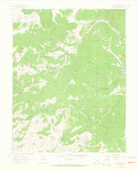
1963 Map of Deer Peak
USGS Topo · Published 1966About this map
San Isabel National Forest dominates this mid-1960s survey of the Wet Mountains, where the high-altitude landscape is defined by the Custer and Huerfano county line. At the center of the sheet, Deer Peak Radio Tower 11572 stands as a prominent man-made landmark amidst a series of alpine parks, including Junkins Park, Antelope Park, and South Hardscrabble Park. These open meadows contrast with the sharp vertical relief of Wixson Mountain and Piltz Mtn.
Find a feature on this map
42 named features on this map. Tap any name to fly to it.
Don’t see what you’re looking for? This feature index may not catch every label — zoom into the map to look around manually.
Map Details
Editions of this 1963 Deer Peak Map
3 editions found
Other maps of this area

1889 · Canon City
USGS Topo · 1:125,000

1889 · Huerfano Park
USGS Topo · 1:125,000

1892 · Huerfano Park
USGS Topo · 1:125,000

1892 · Canon City
USGS Topo · 1:125,000

1954 · Mount Tyndall
USGS Topo · 1:24,000

1954 · Rosita
USGS Topo · 1:24,000

1954 · Trinidad
USGS Topo · 1:250,000

1954 · Pueblo
USGS Topo · 1:250,000

1955 · Trinidad
USGS Topo · 1:250,000

1957 · Pueblo
USGS Topo · 1:250,000