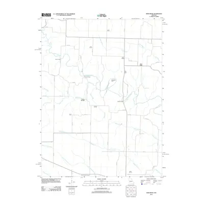
2012 Map of Deer Ridge
USGS Topo · Published 2012About this map
The Middle Fabius River carves a winding path through the northern Lewis County countryside, creating prominent landmarks like the dramatic Horseshoe Bend. This agricultural landscape is anchored by the community of Deer Ridge and the nearby Forest Springs, where rural life is organized around a network of county roads and river crossings. Several distinctive structures bridge the local waterways, including Parrish Bridge, Seaman Bridge, and Limekiln Bridge, indicating the historical importance of maintaining transit across the river's diverse tributaries.
Find a feature on this map
61 named features on this map. Tap any name to fly to it.
Don’t see what you’re looking for? This feature index may not catch every label — zoom into the map to look around manually.
Map Details
Editions of this 2012 Deer Ridge Map
This is the sole edition of this map. No revisions or reprints were ever made.
Other maps of this area

1903 · Kahoka
USGS Topo · 1:125,000

1903 · Edina
USGS Topo · 1:125,000

1950 · Neeper
USGS Topo · 1:24,000

1950 · Williamstown
USGS Topo · 1:24,000

1950 · Lewistown
USGS Topo · 1:24,000

1950 · Colony
USGS Topo · 1:24,000

1950 · La Belle
USGS Topo · 1:24,000

1951 · La Belle
USGS Topo · 1:24,000

1951 · Colony
USGS Topo · 1:24,000

1951 · Neeper
USGS Topo · 1:24,000