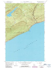
1958 Map of Deer Yard Lake
USGS Topo · Published 1986About this map
Deer Yard Lake sits as the central hydrologic feature of this northern Minnesota landscape, surrounded by the vast timberlands of the Superior National Forest. This 1958 survey, updated through the mid-1980s, highlights a rugged transition from the interior highlands down to the rocky shore of Lake Superior. The Cascade River State Park dominates the eastern corridor, where the Cascade River descends through a series of drops, including Cascade Falls, before meeting the lake.
Find a feature on this map
14 named features on this map. Tap any name to fly to it.
Don’t see what you’re looking for? This feature index may not catch every label — zoom into the map to look around manually.
Map Details
Editions of this 1958 Deer Yard Lake Map
3 editions found
Other maps of this area

1919 · Brule Lake
USGS Topo · 1:62,500

1919 · Grand Marais
USGS Topo · 1:62,500

1919 · Lutsen
USGS Topo · 1:62,500

1954 · Two Harbors
USGS Topo · 1:250,000

1957 · Two Harbors
USGS Topo · 1:250,000

1958 · Two Harbors
USGS Topo · 1:250,000

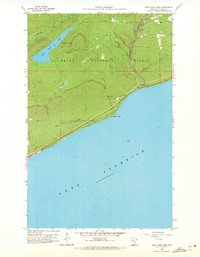
1958 · Deer Yard Lake
USGS Topo · 1:24,000

1958 · Good Harbor Bay
USGS Topo · 1:24,000

1959 · Lutsen
USGS Topo · 1:24,000

1960 · Tait Lake
USGS Topo · 1:24,000