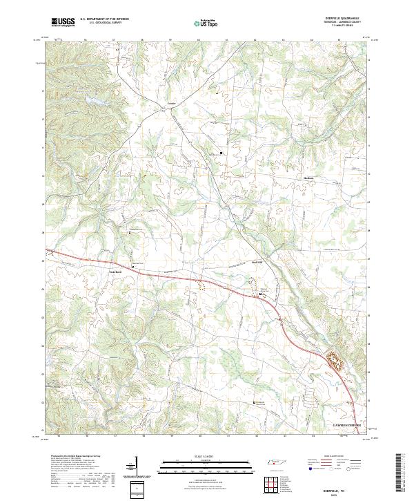
2022 Map of Deerfield
USGS Topo · Published 2022About this map
Deerfield and the outskirts of Lawrenceburg anchor this Tennessee landscape, defined by the winding course of the Little Buffalo River and a network of named springs and branches. The terrain is deeply incised by hollows such as Kilburn Hollow and Bradley Hollow, where the local road network often follows the ridgelines and creek beds. This modern topographic survey captures a community structure still rooted in its ancestral sites, with numerous small burial grounds like Deerfield Cem and Pleasant Grove Cem located near crossroads and watercourses.
Find a feature on this map
106 named features on this map. Tap any name to fly to it.
Don’t see what you’re looking for? This feature index may not catch every label — zoom into the map to look around manually.
Map Details
Editions of this 2022 Deerfield Map
This is the sole edition of this map. No revisions or reprints were ever made.
Other maps of this area

1905 · Waynesboro
USGS Topo · 1:125,000

1936 · Riverside
USGS Topo · 1:24,000

1936 · Westpoint
USGS Topo · 1:24,000

1936 · Deerfield
USGS Topo · 1:24,000

1936 · Henryville
USGS Topo · 1:24,000

1936 · Lawrenceburg
USGS Topo · 1:24,000

1936 · Ethridge
USGS Topo · 1:24,000

1936 · Long Branch
USGS Topo · 1:24,000

1936 · Crestview
USGS Topo · 1:24,000

1936 · Ovilla
USGS Topo · 1:24,000