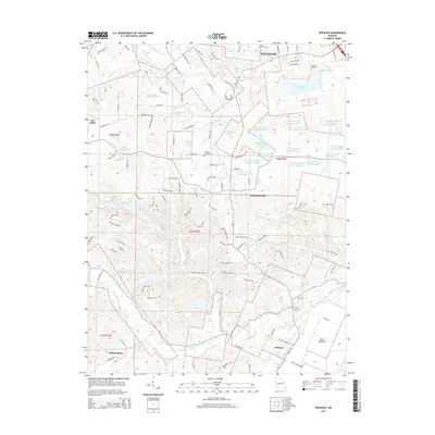
2015 Map of Defiance
USGS Topo · Published 2015About this map
The Missouri River defines the southern boundary of this region, where the alluvial plain of the Darst Bottoms gives way to the rising hills of Saint Charles County. Small agricultural settlements and crossroads like Defiance, Schluersburg, and New Melle anchor the rural landscape, while the southern edge of O'Fallon marks the northern extent of the survey. The central portion of the map is notable for a high concentration of managed water bodies, including several numbered lakes such as August A Busch Lake Number 21 and August A Busch Lake Number 27, which reflect a transition toward conservation and recreation areas. Numerous creeks, including Dardenne Cr and Femme Osage Creek, drain the uplands, while local history is preserved in sites such as Journey Cemetery and Dardenne Cemetery.
Find a feature on this map
119 named features on this map. Tap any name to fly to it.
Don’t see what you’re looking for? This feature index may not catch every label — zoom into the map to look around manually.
Map Details
Editions of this 2015 Defiance Map
This is the sole edition of this map. No revisions or reprints were ever made.
Other maps of this area

1903 · O'Fallon
USGS Topo · 1:125,000

1931 · Brussels
USGS Topo · 1:62,500

1937 · Weldon Spring
USGS Topo · 1:24,000

1939 · Brussels
USGS Topo · 1:62,500

1940 · Eureka
USGS Topo · 1:24,000

1940 · Weldon Spring
USGS Topo · 1:24,000

1941 · Troy
USGS Topo · 1:62,500

1943 · Brussels
USGS Topo · 1:62,500

1944 · Eureka
USGS Topo · 1:24,000

1945 · Troy
USGS Topo · 1:62,500