
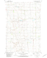
1982 Map of Deisem
USGS Topo · Published 1983About this map
Deisem serves as the small focal point of this rural prairie landscape in LaMoure County, situated along the tracks of the Burlington Northern railroad. The geography is defined by the winding paths of Maple Creek and Cottonwood Creek, which cut through the township divisions of Bluebird, Glenmore, Ray, and Nora. This 1982 map illustrates a post-war agricultural environment where transportation is primarily dictated by the rail line and a grid of secondary roads. Evidence of localized industry and private infrastructure is visible through the Gravel Pit near the creek and the Forsman Landing Strip, indicating how residents adapted to the vast distances of the North Dakota plains. The map provides a detailed look at the section lines and township boundaries that organized the settlement and farming of this region.
Find a feature on this map
10 named features on this map. Tap any name to fly to it.
Don’t see what you’re looking for? This feature index may not catch every label — zoom into the map to look around manually.
Map Details
Editions of this 1982 Deisem Map
This is the sole edition of this map. No revisions or reprints were ever made.
Other maps of this area

1896 · Jamestown
USGS Topo · 1:125,000

1896 · Edgeley
USGS Topo · 1:125,000

1925 · Edgeley
USGS Topo · 1:125,000

1953 · Jamestown
USGS Topo · 1:250,000

1953 · Jud
USGS Topo · 1:24,000

1953 · Nortonville
USGS Topo · 1:24,000

1953 · Jud SE
USGS Topo · 1:24,000

1956 · Jamestown
USGS Topo · 1:250,000

1982 · Schlecht-Weixel Dam
USGS Topo · 1:24,000
1982 · Kulm-Edgeley Dam
USGS Topo · 1:24,000