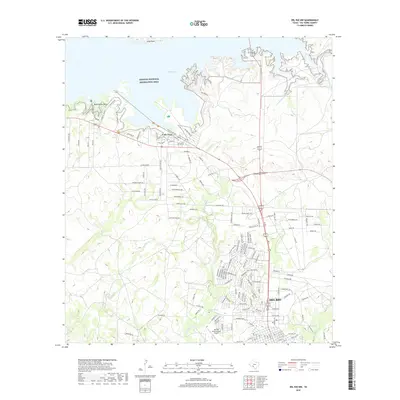
2019 Map of Del Rio NW
USGS Topo · Published 2019About this map
Amistad National Recreation Area dominates the northern landscape of this region, where the reservoir waters of Walk Lake meet the intricate shoreline of Long Point and Black Brush Point. To the south, the expansion of Del Rio is evident in the dense street networks approaching the Del Rio International Airport. The geography is defined by a transition from the protected water recreation lands to the suburban and industrial developments of Val Verde County.
Find a feature on this map
146 named features on this map. Tap any name to fly to it.
Don’t see what you’re looking for? This feature index may not catch every label — zoom into the map to look around manually.
Map Details
Editions of this 2019 Del Rio NW Map
This is the sole edition of this map. No revisions or reprints were ever made.
Other maps of this area

1941 · Feely
USGS Topo · 1:62,500

1943 · Devils River
USGS Topo · 1:62,500

1943 · Del Rio
USGS Topo · 1:62,500

1944 · Devils River
USGS Topo · 1:62,500

1944 · Devils Lake
USGS Topo · 1:62,500

1958 · Del Rio
USGS Topo · 1:250,000

1964 · Del Rio
USGS Topo · 1:250,000

1972 · Amistad Dam
USGS Topo · 1:24,000

1972 · California Creek
USGS Topo · 1:24,000

1972 · Del Rio SW
USGS Topo · 1:24,000
Featured Places
- Del Rio, TX
- Lake View, TX
- Lake View Addition Colonia, TX
- Los Campos Number 1,2 and 5 Colonia, TX
- Los Campos Number 3 and 4 Colonia, TX