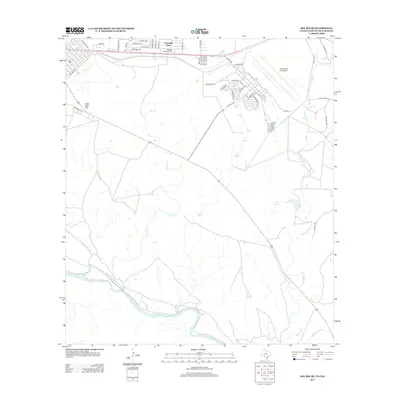
2013 Map of Del Rio SE
USGS Topo · Published 2013About this map
Laughlin Air Force Base dominates the northeastern landscape of this border region, its runways and service roads like Arnold Blvd and Laughlin Dr defining the local geography just south of the main settlement areas. The map details a transition from the suburban outskirts of Val Verde Park and the residential streets near Oaklawn Memorial Park into the more open, arid terrain characteristic of the Texas-Mexico border. To the south, the Rio Grande snakes along the bottom of the sheet, serving as the international boundary. Between the base and the river, the land is marked by significant topographical and hydrological features such as Eagle Pass Hill, Yoas Springs, and the drainage patterns of Sacatosa Cr and Zorro Cr. These waterways carve through the landscape towards the river, highlighting the natural drainage system of the Rio Grande basin.
Find a feature on this map
47 named features on this map. Tap any name to fly to it.
Don’t see what you’re looking for? This feature index may not catch every label — zoom into the map to look around manually.
Map Details
Editions of this 2013 Del Rio SE Map
This is the sole edition of this map. No revisions or reprints were ever made.
Other maps of this area

1941 · Standart
USGS Topo · 1:62,500

1941 · Tequesquite Creek
USGS Topo · 1:62,500

1943 · Standart
USGS Topo · 1:62,500

1943 · Del Rio
USGS Topo · 1:62,500

1944 · Sycamore Ranch
USGS Topo · 1:62,500

1944 · Tequesquite Creek
USGS Topo · 1:62,500

1958 · Del Rio
USGS Topo · 1:250,000

1964 · Del Rio
USGS Topo · 1:250,000

1972 · Del Rio SW
USGS Topo · 1:24,000

1972 · Del Rio SE
USGS Topo · 1:24,000