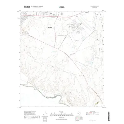
2019 Map of Del Rio SE
USGS Topo · Published 2019About this map
The Rio Grande forms the international boundary in the southwest corner of this region, where the United States of America meets Mexico. Directly east of Del Rio, the landscape is dominated by the sprawling infrastructure of Laughlin Air Force Base, featuring an extensive street network including Colorado Ave and Arkansas St. Residential development is concentrated in the northern section, particularly within the Val Verde Park Colonia and Val Verde Park communities, which sit near the Oaklawn Memorial Park cemetery.
Find a feature on this map
63 named features on this map. Tap any name to fly to it.
Don’t see what you’re looking for? This feature index may not catch every label — zoom into the map to look around manually.
Map Details
Editions of this 2019 Del Rio SE Map
This is the sole edition of this map. No revisions or reprints were ever made.
Other maps of this area

1941 · Standart
USGS Topo · 1:62,500

1941 · Tequesquite Creek
USGS Topo · 1:62,500

1943 · Standart
USGS Topo · 1:62,500

1943 · Del Rio
USGS Topo · 1:62,500

1944 · Sycamore Ranch
USGS Topo · 1:62,500

1944 · Tequesquite Creek
USGS Topo · 1:62,500

1958 · Del Rio
USGS Topo · 1:250,000

1964 · Del Rio
USGS Topo · 1:250,000

1972 · Del Rio SW
USGS Topo · 1:24,000

1972 · Del Rio SE
USGS Topo · 1:24,000