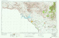
1958 Map of Del Rio
USGS Topo · Published 1976About this map
Del Rio serves as the focal point for this borderland survey, which documents a complex landscape of international boundaries and massive infrastructure projects. The Amistad Reservoir dominates the center of the sheet, where the Pecos River and Devils River converge to meet the Rio Grande. This period shows the military footprint of the region through Laughlin AFB and the historic Ft Clark, while the Southern Pacific railroad provides the primary transit artery across the western brush country. From the isolated outpost of Pumpville in the west to the rugged slopes of the Anacacho Mountains in the east, the map reveals a network of remote ranchlands and small rail settlements like Spofford and Shumla that define the Texas-Mexico frontier.
Find a feature on this map
47 named features on this map. Tap any name to fly to it.
Don’t see what you’re looking for? This feature index may not catch every label — zoom into the map to look around manually.
Map Details
Editions of this 1958 Del Rio Map
2 editions found

Other maps of this area

1893 · Rock Springs
USGS Topo · 1:125,000

1893 · Nueces
USGS Topo · 1:125,000

1896 · Nueces
USGS Topo · 1:125,000

1896 · Brackett
USGS Topo · 1:125,000

1897 · Brackett
USGS Topo · 1:125,000

1898 · Uvalde
USGS Topo · 1:125,000

1899 · Uvalde
USGS Topo · 1:125,000

1918 · Dryden Crossing
USGS Topo · 1:62,500

1928 · Sanderson
USGS Topo · 1:125,000

1938 · Turkey Mountain
USGS Topo · 1:48,000