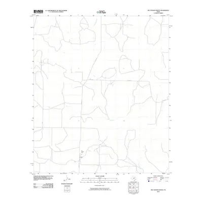
2010 Map of Del Venado Ranch
USGS Topo · Published 2010About this map
Del Venado Ranch anchors this portion of Tom Green County, reflecting the deep-rooted ranching tradition of West Texas during the early 21st century. The landscape is defined by its intermittent drainage systems, notably the paths of Burr Oak Creek in the north and Brady Creek further east, which carve through the terrain. These watercourses and the sparse road network suggest a vast, open territory dedicated to large-scale landholdings. A network of ranch roads and tracks crisscrosses the map, illustrating the functional layout of a working livestock operation and the remote nature of this rural Texas quadrangle at the time of the survey.
Find a feature on this map
3 named features on this map. Tap any name to fly to it.
Don’t see what you’re looking for? This feature index may not catch every label — zoom into the map to look around manually.
Map Details
Editions of this 2010 Del Venado Ranch Map
This is the sole edition of this map. No revisions or reprints were ever made.
Other maps of this area

1892 · San Angelo
USGS Topo · 1:125,000

1892 · Eden
USGS Topo · 1:125,000

1893 · Fort McKavett
USGS Topo · 1:125,000

1896 · Eden
USGS Topo · 1:125,000

1954 · Brownwood
USGS Topo · 1:250,000

1954 · Llano
USGS Topo · 1:250,000

1954 · Sonora
USGS Topo · 1:250,000

1954 · San Angelo
USGS Topo · 1:250,000

1955 · Llano
USGS Topo · 1:250,000

1956 · Llano
USGS Topo · 1:250,000