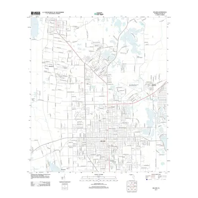
2012 Map of DeLand
USGS Topo · Published 2012About this map
Stetson University serves as a central anchor within this 2012 survey of DeLand, where the urban grid is defined by a high density of neighborhood cemeteries and civic institutions. The landscape is characterized by its numerous lakes, ranging from the large Lake Beresford and Lake Winnemissett to smaller interior basins like Lake Gertie and Lake Molly. These water bodies are interspersed among established residential communities and aviation hubs, including DeLand Municipal Airport-Sidney H Taylor Field and the Bob Lee Flight Strip.
Find a feature on this map
175 named features on this map. Tap any name to fly to it.
Don’t see what you’re looking for? This feature index may not catch every label — zoom into the map to look around manually.
Map Details
Editions of this 2012 DeLand Map
This is the sole edition of this map. No revisions or reprints were ever made.
Other maps of this area

1954 · Daytona Beach
USGS Topo · 1:250,000

1955 · Orlando
USGS Topo · 1:250,000

1957 · Orlando
USGS Topo · 1:250,000

1958 · Orlando
USGS Topo · 1:250,000

1958 · Daytona Beach
USGS Topo · 1:250,000

1962 · Orlando
USGS Topo · 1:250,000

1962 · Pine Lakes
USGS Topo · 1:24,000

1962 · Daytona Beach NW
USGS Topo · 1:24,000

1962 · Daytona Beach SW
USGS Topo · 1:24,000

1962 · Lake Woodruff
USGS Topo · 1:24,000