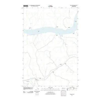
2011 Map of Delaney
USGS Topo · Published 2011About this map
The Snake River dominates the northern landscape of this Columbia County region, its course marked by Lake Bryan and the prominent New York Island. To the south, the terrain transitions into a complex of drainages and small settlements where Pataha Creek joins the Tucannon River. This confluence near the settlement of Delaney illustrates the historical importance of water access for ranching and agriculture in this corner of Washington. The map details the local road network connecting rural outposts like Jackson and Ridpath, while named landmarks such as River Ranch and Rabbit Hollow provide specific points of reference for local family history and land use. The presence of numerous named gulches, including Hanger Gulch and Chard Gulch, reflects a deeply dissected plateau where seasonal water flow has shaped the geography around the winding river valleys.
Find a feature on this map
27 named features on this map. Tap any name to fly to it.
Don’t see what you’re looking for? This feature index may not catch every label — zoom into the map to look around manually.
Map Details
Editions of this 2011 Delaney Map
This is the sole edition of this map. No revisions or reprints were ever made.
Other maps of this area

1919 · Walla Walla
USGS Topo · 1:125,000

1921 · Walla Walla
USGS Topo · 1:125,000

1937 · Pomeroy
USGS Topo · 1:96,000

1942 · Pomeroy
USGS Topo · 1:125,000

1948 · Starbuck
USGS Topo · 1:62,500

1950 · Starbuck
USGS Topo · 1:62,500

1950 · Hay
USGS Topo · 1:62,500

1952 · Hay
USGS Topo · 1:62,500

1953 · Walla Walla
USGS Topo · 1:250,000

1955 · Pullman
USGS Topo · 1:250,000