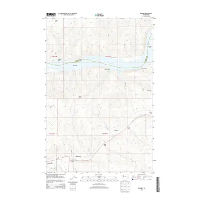
2014 Map of Delaney
USGS Topo · Published 2014About this map
Delaney and the winding course of Pataha Cr define this 2014 survey of the border between Whitman and Columbia Counties. The landscape is dominated by the confluence of major waterways and the complex drainages that feed them. To the north, the Snake River widens into Lake Bryan, featuring New York Island and Little Goose Bay. The southern portion of the map traces the Tucannon River as it meets the Pataha Creek near the small settlement of Delaney, where Wa-261 provides a primary transit link. Named topographic features like Rabbit Hollow, Dry Hollow, and Revere Bar indicate a deeply dissected terrain of gulches and valleys characteristic of the region's agricultural and pastoral history. Small rural outposts like Jackson are connected by local routes such as Field Rd and Ferrall Rd.
Find a feature on this map
34 named features on this map. Tap any name to fly to it.
Don’t see what you’re looking for? This feature index may not catch every label — zoom into the map to look around manually.
Map Details
Editions of this 2014 Delaney Map
This is the sole edition of this map. No revisions or reprints were ever made.
Other maps of this area

1919 · Walla Walla
USGS Topo · 1:125,000

1921 · Walla Walla
USGS Topo · 1:125,000

1937 · Pomeroy
USGS Topo · 1:96,000

1942 · Pomeroy
USGS Topo · 1:125,000

1948 · Starbuck
USGS Topo · 1:62,500

1950 · Starbuck
USGS Topo · 1:62,500

1950 · Hay
USGS Topo · 1:62,500

1952 · Hay
USGS Topo · 1:62,500

1953 · Walla Walla
USGS Topo · 1:250,000

1955 · Pullman
USGS Topo · 1:250,000