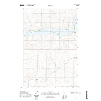
2020 Map of Delaney
USGS Topo · Published 2020About this map
The Snake River defines the northern boundary of this landscape, winding past New York Island and through a series of deep drainages such as Browns Gulch and Hanger Gulch. To the south, the settlement of Delaney sits at the junction of the Pataha Cr and the Tucannon River, marking a transition from the river bluffs to the agricultural expanses of the Pataha Valley. This area reflects the intersection of river-based infrastructure, exemplified by the Little Goose Lock and Dam Airport, and the older overland routes through the breaks. Small localities like Jackson and Ridpath are connected by a network of rural passages including Ridpath Rd and Pataha Ln, while named features like Rabbit Hollow and Chard Gulch provide specific points of interest for those tracing the historical geography of Columbia County.
Find a feature on this map
32 named features on this map. Tap any name to fly to it.
Don’t see what you’re looking for? This feature index may not catch every label — zoom into the map to look around manually.
Map Details
Editions of this 2020 Delaney Map
This is the sole edition of this map. No revisions or reprints were ever made.
Other maps of this area

1919 · Walla Walla
USGS Topo · 1:125,000

1921 · Walla Walla
USGS Topo · 1:125,000

1937 · Pomeroy
USGS Topo · 1:96,000

1942 · Pomeroy
USGS Topo · 1:125,000

1948 · Starbuck
USGS Topo · 1:62,500

1950 · Starbuck
USGS Topo · 1:62,500

1950 · Hay
USGS Topo · 1:62,500

1952 · Hay
USGS Topo · 1:62,500

1953 · Walla Walla
USGS Topo · 1:250,000

1955 · Pullman
USGS Topo · 1:250,000