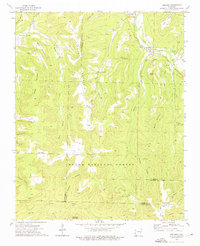
1973 Map of Delaney
USGS Topo · Published 1976About this map
The Middle Fork White River and White River cut through the rugged uplands where Washington and Madison counties meet. This 1970s survey documents a landscape defined by isolated settlements and a deep ridge-and-hollow topography, where small communities like Crosses, Delaney, and Dabney follow the narrow river valleys. High points such as Brannon Mountain and Anderson Knob separate these drainage basins, which are dotted with family-named landmarks like Stacy Mountain and Baker Knob.
Find a feature on this map
55 named features on this map. Tap any name to fly to it.
Don’t see what you’re looking for? This feature index may not catch every label — zoom into the map to look around manually.
Map Details
Editions of this 1973 Delaney Map
2 editions found
Other maps of this area

1879 · Cravens
USGS Topo · 1:62,500

1887 · Watalula
USGS Topo · 1:62,500

1898 · Winslow #4
USGS Topo · 1:62,500

1898 · Winslow
USGS Topo · 1:125,000

1901 · Winslow
USGS Topo · 1:125,000

1939 · Watalula
USGS Topo · 1:62,500

1943 · St. Paul
USGS Topo · 1:62,500

1946 · St. Paul
USGS Topo · 1:62,500

1946 · Fort Smith
USGS Topo · 1:250,000

1956 · Russellville
USGS Topo · 1:250,000