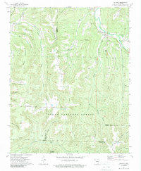
1973 Map of Delaney
USGS Topo · Published 1989About this map
White River headwaters wind through the steep ridges of the Ozark National Forest in this 1970s survey, marking a landscape where high-altitude ridges like Brannon Mountain and Hammond Mountain dictate the placement of small communities and roads. The settlement of Delaney sits along the river near where a major pipeline crosses the terrain, while small clusters of mountain life appear at Brannon, Patrick, and Dabney. Community centers are anchored by landmarks like the Montgomery Chapel and the Health Lookout Tower, which provides a vantage point over the complex system of hollows such as Barnard Hollow and Keets Hollow. The map captures the meeting of four counties—Washington, Madison, Franklin, and Crawford—in a region where local geography is defined by deep stream cuts like Peach Branch and Frog Bayou. This documentation preserves the location of rural spiritual and burial sites, including the Temple Hill Ch and several isolated cemeteries, reflecting the enduring social fabric of these remote Arkansas highlands.
Find a feature on this map
53 named features on this map. Tap any name to fly to it.
Don’t see what you’re looking for? This feature index may not catch every label — zoom into the map to look around manually.
Map Details
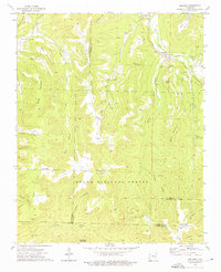
Editions of this 1973 Delaney Map
2 editions found
Other maps of this area

1879 · Cravens
USGS Topo · 1:62,500

1887 · Watalula
USGS Topo · 1:62,500

1898 · Winslow #4
USGS Topo · 1:62,500

1898 · Winslow
USGS Topo · 1:125,000

1901 · Winslow
USGS Topo · 1:125,000

1939 · Watalula
USGS Topo · 1:62,500

1943 · St. Paul
USGS Topo · 1:62,500

1946 · St. Paul
USGS Topo · 1:62,500

1946 · Fort Smith
USGS Topo · 1:250,000

1956 · Russellville
USGS Topo · 1:250,000