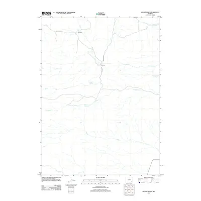
2012 Map of Delano Ranch
USGS Topo · Published 2012About this map
Martin Ranch and Delano Ranch serve as primary anchors for this high-plains landscape in Laramie County. The terrain is defined by a dense network of intermittent drainages, most notably N Chugwater Cr and Mule Cr, which dictate the placement of local infrastructure. Water management for livestock and ranching is evident through man-made features like the Clay Number 1 Reservoir and Miller Number 1 Reservoir. These small reservoirs, along with the paths of Mule Creek Rd and Brush Creek Rd, illustrate the long-standing importance of water access and movement in this part of Wyoming. The map provides a clear look at the hydrologic patterns of the region, including smaller tributaries like Deadhead Cr and Threemile Cr that feed into larger local basins.
Find a feature on this map
14 named features on this map. Tap any name to fly to it.
Don’t see what you’re looking for? This feature index may not catch every label — zoom into the map to look around manually.
Map Details
Editions of this 2012 Delano Ranch Map
This is the sole edition of this map. No revisions or reprints were ever made.
Other maps of this area

1953 · Natwick SW
USGS Topo · 1:24,000

1953 · Richeau Hills
USGS Topo · 1:24,000

1954 · Cheyenne
USGS Topo · 1:250,000

1955 · Poe Mountain
USGS Topo · 1:24,000

1955 · Indian Guide
USGS Topo · 1:24,000

1955 · Goat Mountain
USGS Topo · 1:24,000

1958 · Cheyenne
USGS Topo · 1:250,000

1962 · Farthing
USGS Topo · 1:24,000

1962 · Delano Ranch
USGS Topo · 1:24,000

1962 · Hirsig Ranch
USGS Topo · 1:24,000