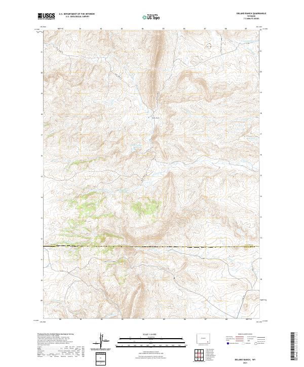
2021 Map of Delano Ranch
USGS Topo · Published 2021About this map
Delano Ranch sits at the center of this high-plains landscape, where the headwaters of numerous creeks carve a complex drainage pattern across the border of Platte and Laramie Counties. The area is defined by its water management for livestock and agriculture, evidenced by the Miller Number 1 Reservoir and Clay Number 1 Reservoir. These catchments support the ranching operations that have long anchored this portion of Wyoming. A network of unpaved arteries, including Mule Creek Rd and Brush Creek Rd, provide the primary access through the broken terrain. Drainage follows the natural contours of the land through seasonal and perennial channels like N Chugwater Cr and Deadhead Cr, illustrating the vital connection between topography and water rights in the Western rangeland.
Find a feature on this map
21 named features on this map. Tap any name to fly to it.
Don’t see what you’re looking for? This feature index may not catch every label — zoom into the map to look around manually.
Map Details
Editions of this 2021 Delano Ranch Map
This is the sole edition of this map. No revisions or reprints were ever made.
Other maps of this area

1953 · Natwick SW
USGS Topo · 1:24,000

1953 · Richeau Hills
USGS Topo · 1:24,000

1954 · Cheyenne
USGS Topo · 1:250,000

1955 · Poe Mountain
USGS Topo · 1:24,000

1955 · Indian Guide
USGS Topo · 1:24,000

1955 · Goat Mountain
USGS Topo · 1:24,000

1958 · Cheyenne
USGS Topo · 1:250,000

1962 · Farthing
USGS Topo · 1:24,000

1962 · Delano Ranch
USGS Topo · 1:24,000

1962 · Hirsig Ranch
USGS Topo · 1:24,000