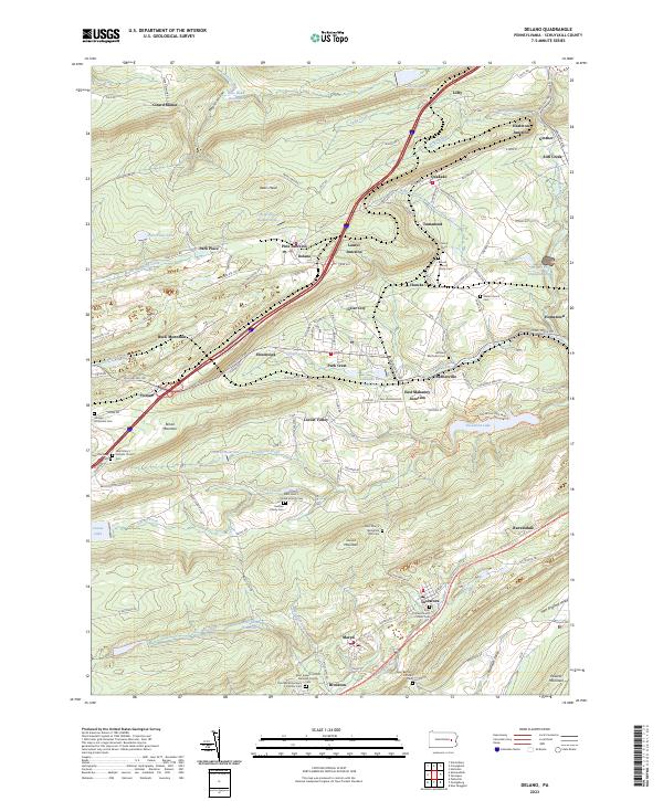
2023 Map of Delano
USGS Topo · Published 2023About this map
Bears Head and Broad Mountain dominate this part of Pennsylvania's coal region, where deep valleys are defined by industrial water management and close-knit settlements. The landscape is dotted with numerous small communities such as Delano, Tamanend, and Brockton, many centered around local parish life and ancestral grounds. Genealogists will find significant value in the concentration of denominational and family burial sites, including the Saint Mary's Byzantine Rite Cem, Brouse - Hauck Family Cem, and Saint Peter's United Church Cem.
Find a feature on this map
154 named features on this map. Tap any name to fly to it.
Don’t see what you’re looking for? This feature index may not catch every label — zoom into the map to look around manually.
Map Details
Editions of this 2023 Delano Map
This is the sole edition of this map. No revisions or reprints were ever made.
Other maps of this area

1889 · Hazleton
USGS Topo · 1:62,500

1889 · Pottsville
USGS Topo · 1:62,500

1891 · Hazleton
USGS Topo · 1:62,500

1891 · Pottsville
USGS Topo · 1:62,500

1892 · Mahanoy
USGS Topo · 1:62,500

1893 · Hazleton
USGS Topo · 1:62,500

1893 · Mahanoy
USGS Topo · 1:62,500

1909 · Hamburg
USGS Topo · 1:62,500

1911 · Hamburg
USGS Topo · 1:62,500

1944 · Pottsville
USGS Topo · 1:24,000
Featured Places
- Hometown, Rush Township
- Delano, Delano Township
- Delano Township, PA
- Blythe Township, PA
- East Union Township, PA