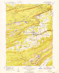
1949 Map of Delano
USGS Topo · Published 1949About this map
Industrial rail infrastructure and steep ridge topography dominate this 1940s Pennsylvania landscape, where the Reading and Lehigh Valley railroads converge at key junctions like East Mahanoy Jct and Tamanend. The anthracite coal region's complex water management is visible through numbered reservoirs near Delano and the Kaier Res further west. Settlement patterns follow the narrow valley floors beneath Broad Mountain and Locust Mountain, punctuated by coal-era landmarks like the Primrose Mine and the Mahanoy Tunnel Sta. Genealogy researchers can locate several rural institutions, including St Nicholas Cem, the Messerschmidt Sch, and the St Peters Ch near Klingerman. The presence of the Barnesville Landing Field near Barnesville contrasts with the heavy heavy industry, while the Schuylkill River begins its course in the southern reach of the quadrangle.
Find a feature on this map
67 named features on this map. Tap any name to fly to it.
Don’t see what you’re looking for? This feature index may not catch every label — zoom into the map to look around manually.
Map Details
Editions of this 1949 Delano Map
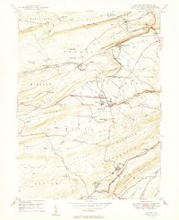
2 editions found
Other maps of this area

1889 · Hazleton
USGS Topo · 1:62,500

1889 · Pottsville
USGS Topo · 1:62,500

1891 · Hazleton
USGS Topo · 1:62,500

1891 · Pottsville
USGS Topo · 1:62,500

1892 · Mahanoy
USGS Topo · 1:62,500

1893 · Hazleton
USGS Topo · 1:62,500

1893 · Mahanoy
USGS Topo · 1:62,500

1909 · Hamburg
USGS Topo · 1:62,500

1911 · Hamburg
USGS Topo · 1:62,500

1944 · Pottsville
USGS Topo · 1:24,000
Featured Places
- Hometown, Rush Township
- Delano, Delano Township
- Schuylkill Township, PA
- Haucks, Rush Township
- Buck Mountain, Mahanoy Township