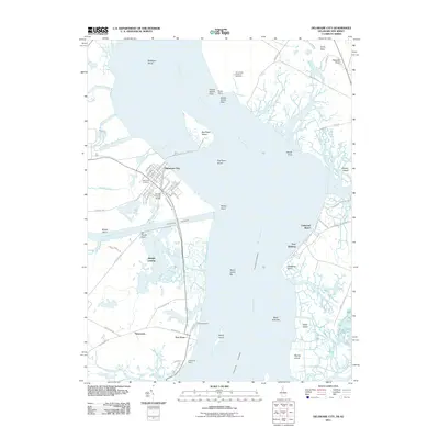
2011 Map of Delaware City
USGS Topo · Published 2011About this map
Delaware City serves as the hub of this maritime landscape, positioned where the Chesapeake and Delaware Canal meets the Delaware River. The map details a complex network of waterways and low-lying coastal features, including the strategically significant Pea Patch Island and the lighthouse-adjacent Reedy Island. Moving south along the western shore, small riverside communities like Thorntown, Port Penn, and Augustine Beach indicate a long history of river-dependent settlement.
Find a feature on this map
74 named features on this map. Tap any name to fly to it.
Don’t see what you’re looking for? This feature index may not catch every label — zoom into the map to look around manually.
Map Details
Editions of this 2011 Delaware City Map
This is the sole edition of this map. No revisions or reprints were ever made.
Other maps of this area

1890 · Salem
USGS Topo · 1:62,500

1890 · Bay Side
USGS Topo · 1:62,500

1894 · Bay Side
USGS Topo · 1:62,500

1898 · Salem
USGS Topo · 1:62,500

1899 · Vineland
USGS Topo · 1:125,000

1899 · Dover
USGS Topo · 1:125,000

1901 · Camden
USGS Topo · 1:125,000

1904 · Wilmington
USGS Topo · 1:62,500

1906 · Dover
USGS Topo · 1:125,000

1906 · Wilmington
USGS Topo · 1:62,500
Featured Places
- Pennsville Township, NJ
- Lower Alloways Creek Township, NJ
- Delaware City, DE
- Shingle Landing, DE
- Oakwood Beach, Elsinboro Township