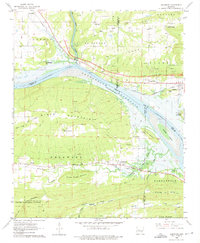
1962 Map of Delaware
USGS Topo · Published 1975About this map
The Arkansas River valley undergoes a significant transformation as the Dardanelle Reservoir begins to shape the landscape between Delaware and London. Blue hatching across the map indicates specific low-lying areas along the river and Big Piney Creek designated to be submerged by the reservoir's normal pool elevation. This transition era is captured alongside established transport corridors like the Missouri Pacific Railroad and an Old Railroad Grade that runs through the southern townships.
Find a feature on this map
66 named features on this map. Tap any name to fly to it.
Don’t see what you’re looking for? This feature index may not catch every label — zoom into the map to look around manually.
Map Details
Editions of this 1962 Delaware Map
2 editions found
Other maps of this area

1888 · Dardanelle #4
USGS Topo · 1:62,500

1888 · Dardanelle #2
USGS Topo · 1:62,500

1888 · Dardanelle #1
USGS Topo · 1:62,500

1888 · Dardanelle #3
USGS Topo · 1:62,500

1890 · Dardanelle
USGS Topo · 1:125,000

1956 · Russellville
USGS Topo · 1:250,000
1962 · Knoxville
USGS Topo · 1:24,000
1962 · New Blaine
USGS Topo · 1:24,000

1962 · Delaware
USGS Topo · 1:24,000
1962 · Clarksville
USGS Topo · 1:24,000