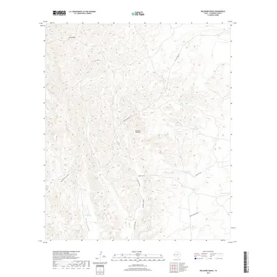
2019 Map of Delaware Ranch
USGS Topo · Published 2019About this map
The Delaware Mountains dominate this high-desert landscape in Culberson County, where a network of seasonal water sources and canyons defines the region's ranching infrastructure. Managed water features such as Scott House Tank, Cowan Tank, and the naturally occurring Rock Water Hole illustrate the critical importance of moisture management in this arid West Texas environment. Transportation through the complex topography is facilitated by the Casa De Piedras Rd and Looney Spur Rd, which snake between high ridges and deep drainages like Maverick Canyon and Ed Ray Canyon. This 2019 survey provides a contemporary view of the land as it appeared in the late 2010s, showing how legacy ranching place-names like Emory Draw and Paint Horse Draw persist even as modern mapping standards are applied.
Find a feature on this map
16 named features on this map. Tap any name to fly to it.
Don’t see what you’re looking for? This feature index may not catch every label — zoom into the map to look around manually.
Map Details
Editions of this 2019 Delaware Ranch Map
This is the sole edition of this map. No revisions or reprints were ever made.
Other maps of this area

1906 · Van Horn
USGS Topo · 1:125,000

1928 · Kent
USGS Topo · 1:125,000

1954 · Van Horn
USGS Topo · 1:250,000

1958 · Van Horn
USGS Topo · 1:250,000

1972 · Seven Heart Gap
USGS Topo · 1:24,000

1972 · Square Mesa
USGS Topo · 1:24,000

1973 · K C Ranch
USGS Topo · 1:24,000
1973 · Dome Hill
USGS Topo · 1:24,000
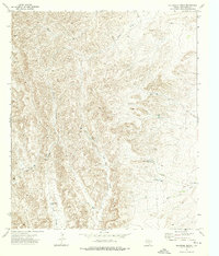
1973 · Delaware Ranch
USGS Topo · 1:24,000

1973 · Burro Canyon
USGS Topo · 1:24,000