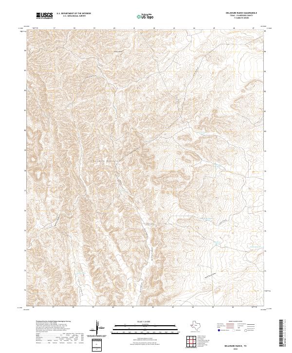
2022 Map of Delaware Ranch
USGS Topo · Published 2022About this map
The Delaware Mountains of Culberson County define this high-desert landscape, where drainage patterns and vital water catchments dictate the movement of people and livestock. In this arid reach of West Texas, the naming of features such as Rock Water Hole and Saint John Tank underscores the primary importance of reliable water sources for ranching operations. The terrain is deeply incised by a series of significant canyons, including Maverick Canyon and Ed Ray Canyon, while broader drainage systems like Emory Draw and Paint Horse Draw channel intermittent flows across the rugged topography. Human infrastructure is minimal, represented largely by unpaved tracks like Casa De Piedras Rd and Looney Spur Rd, which connect isolated water tanks such as Scott House Tank and Segunda Tank.
Find a feature on this map
17 named features on this map. Tap any name to fly to it.
Don’t see what you’re looking for? This feature index may not catch every label — zoom into the map to look around manually.
Map Details
Editions of this 2022 Delaware Ranch Map
This is the sole edition of this map. No revisions or reprints were ever made.
Other maps of this area

1906 · Van Horn
USGS Topo · 1:125,000

1928 · Kent
USGS Topo · 1:125,000

1954 · Van Horn
USGS Topo · 1:250,000

1958 · Van Horn
USGS Topo · 1:250,000

1972 · Seven Heart Gap
USGS Topo · 1:24,000

1972 · Square Mesa
USGS Topo · 1:24,000

1973 · K C Ranch
USGS Topo · 1:24,000
1973 · Dome Hill
USGS Topo · 1:24,000
1973 · Delaware Ranch
USGS Topo · 1:24,000

1973 · Burro Canyon
USGS Topo · 1:24,000