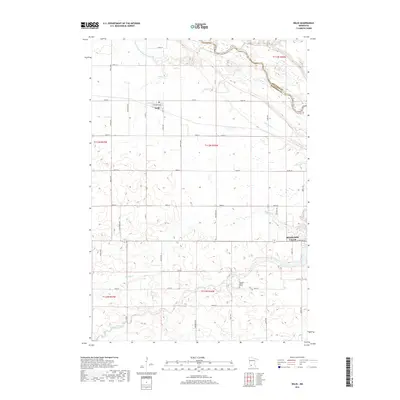
2019 Map of Delhi
USGS Topo · Published 2019About this map
Redwood Falls and the small settlement of Delhi occupy this prairie landscape where the Minnesota River and Redwood River converge. The topography is defined by the deep incision of these river valleys into the surrounding agricultural tableland, a pattern particularly visible at the sharp drop of Ramsey Falls on the southern edge of the quadrangle. Local heritage is uniquely preserved at the Orange C Martin Grave, a lonely landmark located in the open fields south of the main river corridor.
Find a feature on this map
42 named features on this map. Tap any name to fly to it.
Don’t see what you’re looking for? This feature index may not catch every label — zoom into the map to look around manually.
Map Details
Editions of this 2019 Delhi Map
This is the sole edition of this map. No revisions or reprints were ever made.
Other maps of this area

1952 · Redwood Falls
USGS Topo · 1:62,500

1953 · New Ulm
USGS Topo · 1:250,000

1957 · New Ulm
USGS Topo · 1:250,000

1958 · New Ulm
USGS Topo · 1:250,000

1965 · Belview
USGS Topo · 1:24,000

1965 · Iverson Lake
USGS Topo · 1:24,000

1967 · New Ulm
USGS Topo · 1:250,000

1967 · Clements
USGS Topo · 1:24,000

1967 · Wabasso
USGS Topo · 1:24,000

1967 · Rowena
USGS Topo · 1:24,000