
1967 Map of Wabasso
USGS Topo · Published 1968About this map
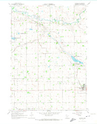
The Redwood River meanders across the northern portion of this Redwood County landscape, defining the rural character of Vesta and Sheridan townships in the late 1960s. The Chicago and North Western railroad corridor serves as the primary industrial spine, linking the established settlements of Wabasso and Seaforth. This era shows a heavily managed agricultural water system, evidenced by numerous engineered waterways such as Clear Ditch and Judicial Ditch No 31. Local history is preserved at St Marys Cem and St Pauls Cem, while the preservation of natural habitats is seen in several dedicated zones including the Daubs Lake State Wildlife Management Area and Paul State Wildlife Management Area. The presence of many Gravel Pits throughout the quadrangle highlights the importance of local mineral extraction to the region's development during this period.
Find a feature on this map
29 named features on this map. Tap any name to fly to it.
Don’t see what you’re looking for? This feature index may not catch every label — zoom into the map to look around manually.
Map Details
Editions of this 1967 Wabasso Map
2 editions found
Other maps of this area

1952 · Redwood Falls
USGS Topo · 1:62,500

1953 · New Ulm
USGS Topo · 1:250,000

1957 · New Ulm
USGS Topo · 1:250,000

1958 · New Ulm
USGS Topo · 1:250,000

1965 · Echo
USGS Topo · 1:24,000

1965 · Belview
USGS Topo · 1:24,000

1967 · New Ulm
USGS Topo · 1:250,000

1967 · Wanda
USGS Topo · 1:24,000

1967 · Wabasso SE
USGS Topo · 1:24,000

1967 · Rowena
USGS Topo · 1:24,000