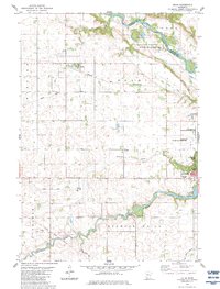
1983 Map of Delhi
USGS Topo · Published 1983About this map
The Minnesota River and Redwood River converge in this corner of southwestern Minnesota, where the township of Delhi sits along the Chicago and North Western rail line. The landscape is defined by its agricultural drainage network, including Judicial Ditch No 33 and Judicial Ditch No 12, which crisscross the prairie to manage the water flow toward the river valleys. A significant historical marker, the Old Indian Treaty Boundary, cuts diagonally across the terrain, reflecting the 19th-century land divisions of the region.
Find a feature on this map
32 named features on this map. Tap any name to fly to it.
Don’t see what you’re looking for? This feature index may not catch every label — zoom into the map to look around manually.
Map Details
Editions of this 1983 Delhi Map
This is the sole edition of this map. No revisions or reprints were ever made.
Other maps of this area

1952 · Redwood Falls
USGS Topo · 1:62,500

1953 · New Ulm
USGS Topo · 1:250,000

1957 · New Ulm
USGS Topo · 1:250,000

1958 · New Ulm
USGS Topo · 1:250,000

1965 · Belview
USGS Topo · 1:24,000

1965 · Iverson Lake
USGS Topo · 1:24,000

1967 · New Ulm
USGS Topo · 1:250,000

1967 · Clements
USGS Topo · 1:24,000

1967 · Wabasso
USGS Topo · 1:24,000

1967 · Rowena
USGS Topo · 1:24,000