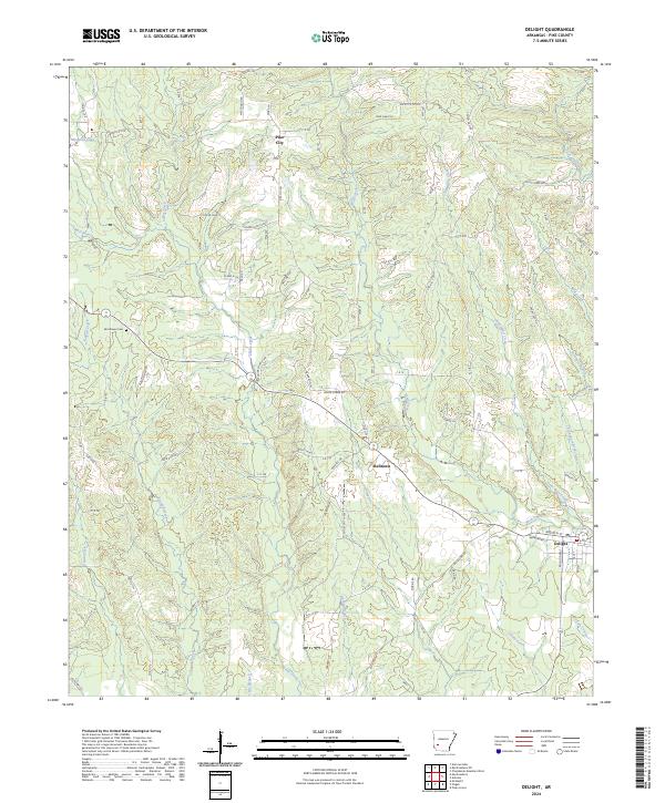
2024 Map of Delight
USGS Topo · Published 2024About this map
Delight and Pike City anchor this section of Pike County, where the landscape is defined by the winding drainages of the Saline Creek and Wolf Creek systems. The settlement pattern follows established corridors like the Pike City Rd and Billstown Rd, connecting small clusters of homes and family landmarks. For genealogists and local historians, the map preserves the location of Brocktown Cem and smaller settlements such as Stelltown. The terrain is characterized by numerous small waterways, including Wildcat Spring, Mill Branch, and Chinquapin Branch, which likely influenced early homesteading and agriculture in the region. The presence of W Railroad St in Delight points to the town's historical connection to rail transport, while the surrounding hills are dotted with local names like Red Hill Rd and Deer Camp Rd.
Find a feature on this map
44 named features on this map. Tap any name to fly to it.
Don’t see what you’re looking for? This feature index may not catch every label — zoom into the map to look around manually.
Map Details
Editions of this 2024 Delight Map
This is the sole edition of this map. No revisions or reprints were ever made.
Other maps of this area

1901 · Gurdon
USGS Topo · 1:125,000

1906 · Caddo Gap
USGS Topo · 1:125,000

1943 · Antoine
USGS Topo · 1:62,500

1951 · Pisgah
USGS Topo · 1:24,000

1951 · McCaskill
USGS Topo · 1:24,000

1953 · El Dorado
USGS Topo · 1:250,000

1955 · Little Rock
USGS Topo · 1:250,000

1956 · Little Rock
USGS Topo · 1:250,000

1957 · El Dorado
USGS Topo · 1:250,000

1958 · El Dorado
USGS Topo · 1:250,000