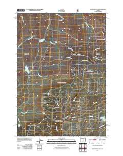
2011 Map of Delintment Lake
USGS Topo · Published 2011About this map
Mills Upper Ranch and Sherman Ranch anchor the high-country landscape of central Oregon as it appeared in the early 21st century. The terrain is defined by a complex network of seasonal and perennial drainages including Grindstone Creek, Copper Creek, and Silver Creek, which descend from the slopes of Iron Mountain. Water management is central to the area's geography, evidenced by the presence of Grindstone Reservoir, Williams Reservoir, and the namesake Delintment Lake in the southeast corner. Numerous named water sources such as Jimmy McCuen Spring and Tip Top Spring suggest the critical importance of reliable water for ranching and wildlife. A dense web of forest and ranch roads, including Mills Ranch Rd and Nat For Dev Rd 4175, provides the primary infrastructure through these remote reaches of the Ochoco National Forest area.
Find a feature on this map
31 named features on this map. Tap any name to fly to it.
Don’t see what you’re looking for? This feature index may not catch every label — zoom into the map to look around manually.
Map Details
Editions of this 2011 Delintment Lake Map
This is the sole edition of this map. No revisions or reprints were ever made.
Other maps of this area

1932 · Dayville
USGS Topo · 1:125,000

1936 · Dayville
USGS Topo · 1:125,000

1955 · Burns
USGS Topo · 1:250,000

1955 · Canyon City
USGS Topo · 1:250,000

1958 · Burns
USGS Topo · 1:250,000

1959 · Burns
USGS Topo · 1:250,000

1959 · Canyon City
USGS Topo · 1:250,000

1961 · Delintment Lake
USGS Topo · 1:62,500

1981 · Suplee
USGS Topo · 1:24,000

1981 · Dayville
USGS Topo · 1:100,000