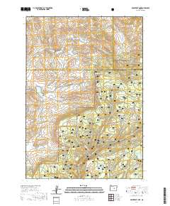
2020 Map of Delintment Lake
USGS Topo · Published 2020About this map
Ochoco National Forest dominates this high-desert landscape in Eastern Oregon, where the headwaters of numerous creeks and springs define the local geography. The area is a critical drainage point for several mountain streams, including Grindstone Creek and Twelvemile Creek, which navigate the complex terrain. Prominent landmarks such as Iron Mountain provide vertical relief in a region otherwise defined by its hydrological network.
Find a feature on this map
30 named features on this map. Tap any name to fly to it.
Don’t see what you’re looking for? This feature index may not catch every label — zoom into the map to look around manually.
Map Details
Editions of this 2020 Delintment Lake Map
This is the sole edition of this map. No revisions or reprints were ever made.
Other maps of this area

1932 · Dayville
USGS Topo · 1:125,000

1936 · Dayville
USGS Topo · 1:125,000

1955 · Burns
USGS Topo · 1:250,000

1955 · Canyon City
USGS Topo · 1:250,000

1958 · Burns
USGS Topo · 1:250,000

1959 · Burns
USGS Topo · 1:250,000

1959 · Canyon City
USGS Topo · 1:250,000

1961 · Delintment Lake
USGS Topo · 1:62,500

1981 · Suplee
USGS Topo · 1:24,000

1981 · Dayville
USGS Topo · 1:100,000