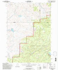
1992 Map of Delintment Lake
USGS Topo · Published 1997About this map
Delintment Lake and its accompanying Boat Ramp serve as a central hub for this high-desert landscape within the Ochoco National Forest. The 1990s terrain is defined by a critical network of water management, ranging from the Grindstone Reservoir and Twelvemile Reservoir to numerous named springs like Jimmy McCuen Spring and Robertson Spring. These features suggest a landscape heavily utilized for livestock and forest management, where reliable water sources are paramount. High points such as Iron Mountain and White Butte punctuate the topography, while the intersection of Grant, Crook, and Harney county lines underscores the remote, administrative nature of this forest land. The presence of a Corral and various Stock Ponds reflects the seasonal ranching traditions integrated into the forest's multi-use history.
Find a feature on this map
35 named features on this map. Tap any name to fly to it.
Don’t see what you’re looking for? This feature index may not catch every label — zoom into the map to look around manually.
Map Details
Editions of this 1992 Delintment Lake Map
This is the sole edition of this map. No revisions or reprints were ever made.
Other maps of this area

1932 · Dayville
USGS Topo · 1:125,000

1936 · Dayville
USGS Topo · 1:125,000

1955 · Burns
USGS Topo · 1:250,000

1955 · Canyon City
USGS Topo · 1:250,000

1958 · Burns
USGS Topo · 1:250,000

1959 · Burns
USGS Topo · 1:250,000

1959 · Canyon City
USGS Topo · 1:250,000

1961 · Delintment Lake
USGS Topo · 1:62,500

1981 · Suplee
USGS Topo · 1:24,000

1981 · Dayville
USGS Topo · 1:100,000