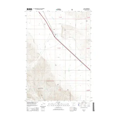
2014 Map of Dell
USGS Topo · Published 2014About this map
The settlement of Dell serves as the central hub of this high-country survey, situated where the Red Rock River Valley meets the foothills of the Beaverhead National Forest. This landscape is defined by the complex water systems essential for Montana ranching, featuring an extensive network of named springs such as Garr Spring Number One and Hansen Spring. The transportation infrastructure is anchored by the Dell Flight Strip and the Big Sheep Creek Bridge, facilitating movement through the corridor bounded by Red Butte to the north and the prominent White Pine Ridge to the south.
Find a feature on this map
47 named features on this map. Tap any name to fly to it.
Don’t see what you’re looking for? This feature index may not catch every label — zoom into the map to look around manually.
Map Details
Editions of this 2014 Dell Map
This is the sole edition of this map. No revisions or reprints were ever made.
Other maps of this area

1955 · Dubois
USGS Topo · 1:250,000

1958 · Dubois
USGS Topo · 1:250,000

1965 · Kidd
USGS Topo · 1:24,000

1965 · Caboose Canyon
USGS Topo · 1:24,000

1965 · Gallagher Gulch
USGS Topo · 1:24,000

1965 · Lima
USGS Topo · 1:24,000

1965 · Briggs Ranch
USGS Topo · 1:24,000

1965 · Rock Island Ranch
USGS Topo · 1:24,000

1965 · Dixon Mountain
USGS Topo · 1:24,000

1965 · Dell
USGS Topo · 1:24,000