
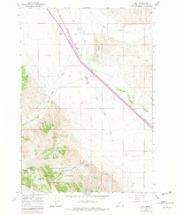
1965 Map of Dell
USGS Topo · Published 1969About this map
The Union Pacific railroad corridor anchors this 1965 survey of the Centennial Valley, where the settlement of Dell sits at the base of the prominent Red Butte. This landscape is defined by the drainage of the Red Rock River and its major tributaries, including Big Sheep Creek and Little Sheep Creek. While the valley floor supports transportation infrastructure like the Dell Airport and its accompanying Airway Beacon, the southwest portion of the sheet rises sharply into the Beaverhead National Forest. This mountainous terrain is characterized by a network of named water sources such as Garr Spring and Hansen Spring, and features like Chute Canyon and White Pine Ridge. The map captures a high-desert ranching environment where water rights and access to the timbered ridges were essential for local survival and operations in Beaverhead County.
Find a feature on this map
35 named features on this map. Tap any name to fly to it.
Don’t see what you’re looking for? This feature index may not catch every label — zoom into the map to look around manually.
Map Details
Editions of this 1965 Dell Map
3 editions found
Other maps of this area

1955 · Dubois
USGS Topo · 1:250,000

1958 · Dubois
USGS Topo · 1:250,000

1965 · Kidd
USGS Topo · 1:24,000

1965 · Caboose Canyon
USGS Topo · 1:24,000

1965 · Gallagher Gulch
USGS Topo · 1:24,000

1965 · Lima
USGS Topo · 1:24,000

1965 · Briggs Ranch
USGS Topo · 1:24,000

1965 · Rock Island Ranch
USGS Topo · 1:24,000

1965 · Dixon Mountain
USGS Topo · 1:24,000

1965 · Lima Peaks
USGS Topo · 1:24,000