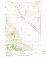
1965 Map of Dell
USGS Topo · Published 1979About this map
Dell sits as a high-altitude outpost along the Union Pacific rail line, serving as a primary node for the livestock and ranching interests of southern Montana. This 1965 survey illustrates a landscape defined by the intersection of mountain geography and essential infrastructure, where the Red Rock River and Sage Creek carve paths through the valley floor. To the west, the topography rises sharply into the Beaverhead National Forest, a region marked by numerous water sources such as Garr Spring and Lyon Spring, which supported the surrounding grazing lands.
Find a feature on this map
35 named features on this map. Tap any name to fly to it.
Don’t see what you’re looking for? This feature index may not catch every label — zoom into the map to look around manually.
Map Details
Editions of this 1965 Dell Map
3 editions found
Other maps of this area

1955 · Dubois
USGS Topo · 1:250,000

1958 · Dubois
USGS Topo · 1:250,000

1965 · Kidd
USGS Topo · 1:24,000

1965 · Caboose Canyon
USGS Topo · 1:24,000

1965 · Gallagher Gulch
USGS Topo · 1:24,000

1965 · Lima
USGS Topo · 1:24,000

1965 · Briggs Ranch
USGS Topo · 1:24,000

1965 · Rock Island Ranch
USGS Topo · 1:24,000

1965 · Dixon Mountain
USGS Topo · 1:24,000

1965 · Dell
USGS Topo · 1:24,000