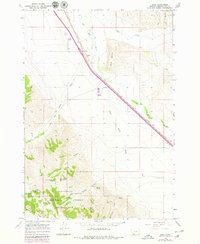
1965 Map of Dell
USGS Topo · Published 1979About this map
The Union Pacific railroad corridor anchors this high-country landscape, running parallel to the Red Rock River through the settlement of Dell. This 1965 survey, updated through the late 1970s, captures the vital infrastructure of the era, from the Dell Airport and its Airway Beacon to the network of jeep trails winding toward the Beaverhead National Forest.
Find a feature on this map
31 named features on this map. Tap any name to fly to it.
Don’t see what you’re looking for? This feature index may not catch every label — zoom into the map to look around manually.
Map Details
Editions of this 1965 Dell Map
3 editions found
Other maps of this area

1955 · Dubois
USGS Topo · 1:250,000

1958 · Dubois
USGS Topo · 1:250,000

1965 · Kidd
USGS Topo · 1:24,000

1965 · Caboose Canyon
USGS Topo · 1:24,000

1965 · Gallagher Gulch
USGS Topo · 1:24,000

1965 · Lima
USGS Topo · 1:24,000

1965 · Briggs Ranch
USGS Topo · 1:24,000

1965 · Rock Island Ranch
USGS Topo · 1:24,000

1965 · Dixon Mountain
USGS Topo · 1:24,000

1965 · Dell
USGS Topo · 1:24,000