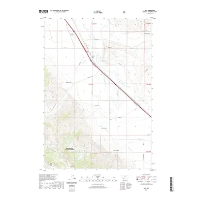
2020 Map of Dell
USGS Topo · Published 2020About this map
The Oregon Short Line railroad corridor dictates the settlement pattern of this Montana landscape, running parallel to the Red Rock River through the heart of the valley. The small community of Dell serves as a central point for local transportation, supported by the nearby Dell Flight Strip and the Big Sheep Creek Bridge. This 2020 survey illustrates how modern infrastructure follows the same natural routes established by early pioneers and rail engineers, with the W Side Frontage Rd and Interstate system tracing the historic path toward the Continental Divide.
Find a feature on this map
94 named features on this map. Tap any name to fly to it.
Don’t see what you’re looking for? This feature index may not catch every label — zoom into the map to look around manually.
Map Details
Editions of this 2020 Dell Map
This is the sole edition of this map. No revisions or reprints were ever made.
Other maps of this area

1955 · Dubois
USGS Topo · 1:250,000

1958 · Dubois
USGS Topo · 1:250,000

1965 · Kidd
USGS Topo · 1:24,000

1965 · Caboose Canyon
USGS Topo · 1:24,000

1965 · Gallagher Gulch
USGS Topo · 1:24,000

1965 · Lima
USGS Topo · 1:24,000

1965 · Briggs Ranch
USGS Topo · 1:24,000

1965 · Rock Island Ranch
USGS Topo · 1:24,000

1965 · Dixon Mountain
USGS Topo · 1:24,000

1965 · Dell
USGS Topo · 1:24,000