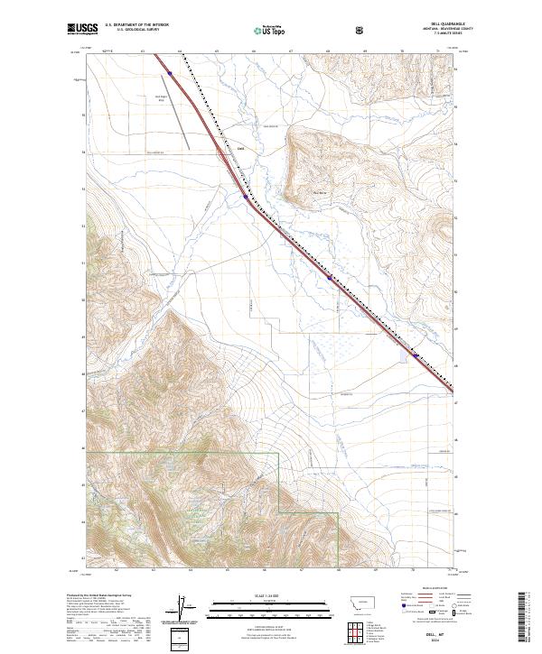
2024 Map of Dell
USGS Topo · Published 2024About this map
Red Rock River valley serves as the primary corridor for transportation and settlement in this portion of Beaverhead County. The small community of Dell is anchored by the historic Oregon Short Line railroad and the adjacent Dell Flight Strip, reflecting the area's role as a transit waypoint in the high mountain basins. To the west, the Tendoy Mountains rise sharply, dissected by numerous drainages including Deadwood Gulch and Garr Canyon.
Find a feature on this map
52 named features on this map. Tap any name to fly to it.
Don’t see what you’re looking for? This feature index may not catch every label — zoom into the map to look around manually.
Map Details
Editions of this 2024 Dell Map
This is the sole edition of this map. No revisions or reprints were ever made.
Other maps of this area

1955 · Dubois
USGS Topo · 1:250,000

1958 · Dubois
USGS Topo · 1:250,000

1965 · Kidd
USGS Topo · 1:24,000

1965 · Caboose Canyon
USGS Topo · 1:24,000

1965 · Gallagher Gulch
USGS Topo · 1:24,000

1965 · Lima
USGS Topo · 1:24,000

1965 · Briggs Ranch
USGS Topo · 1:24,000

1965 · Rock Island Ranch
USGS Topo · 1:24,000

1965 · Dixon Mountain
USGS Topo · 1:24,000

1965 · Dell
USGS Topo · 1:24,000