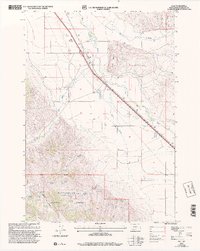
1997 Map of Dell
USGS Topo · Published 2002About this map
The high-plains settlement of Dell serves as the focal point of this 1990s landscape, positioned along the transport corridor that follows the Red Rock River. The map details a transition from the agricultural operations of the valley floor to the protected lands of the Beaverhead National Forest. This era shows the critical infrastructure supporting the region, including the Dell Airport and its accompanying Airway Beacon, as well as the Substa located along the highway.
Find a feature on this map
39 named features on this map. Tap any name to fly to it.
Don’t see what you’re looking for? This feature index may not catch every label — zoom into the map to look around manually.
Map Details
Editions of this 1997 Dell Map
This is the sole edition of this map. No revisions or reprints were ever made.
Other maps of this area

1955 · Dubois
USGS Topo · 1:250,000

1958 · Dubois
USGS Topo · 1:250,000

1965 · Kidd
USGS Topo · 1:24,000

1965 · Caboose Canyon
USGS Topo · 1:24,000

1965 · Gallagher Gulch
USGS Topo · 1:24,000

1965 · Lima
USGS Topo · 1:24,000

1965 · Briggs Ranch
USGS Topo · 1:24,000

1965 · Rock Island Ranch
USGS Topo · 1:24,000

1965 · Dixon Mountain
USGS Topo · 1:24,000

1965 · Dell
USGS Topo · 1:24,000