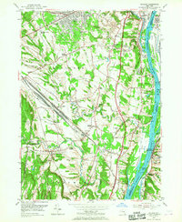
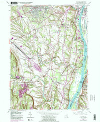
1953 Map of Delmar
USGS Topo · Published 1967About this map
The Hudson River corridor south of Albany defines this landscape during a period of significant infrastructure expansion. The New York State Thruway is shown in its development phase, cutting a path through the traditional agricultural and residential lands of Bethlehem. This transition is most visible near the massive Selkirk Yards rail complex and the nearby Selkirk Airport, illustrating the area's role as a transportation hub for the Capital Region.
Find a feature on this map
78 named features on this map. Tap any name to fly to it.
Don’t see what you’re looking for? This feature index may not catch every label — zoom into the map to look around manually.
Map Details
Editions of this 1953 Delmar Map
5 editions found
Other maps of this area

1893 · Troy
USGS Topo · 1:62,500

1893 · Coxsackie
USGS Topo · 1:62,500

1893 · Albany
USGS Topo · 1:62,500

1894 · Coxsackie
USGS Topo · 1:62,500

1895 · Troy
USGS Topo · 1:62,500

1895 · Albany
USGS Topo · 1:62,500

1898 · Albany
USGS Topo · 1:62,500

1898 · Troy
USGS Topo · 1:62,500

1903 · Kinderhook
USGS Topo · 1:62,500

1925 · Troy
USGS Topo · 1:48,000