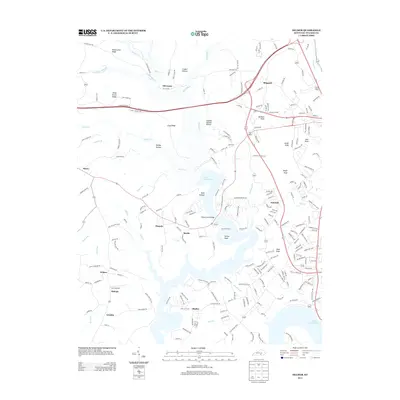
2013 Map of Delmer
USGS Topo · Published 2013About this map
Lake Cumberland dominates this 2013 landscape, its intricate fingers carving into the terrain to create distinctive landmarks like Potato Knoll and the narrow Shafter peninsula. The map reveals a transition from the structured residential clusters near Oak Hill to the rural expanses of Nancy and Delmer further west. Notable infrastructure highlights include the Fishing Creek Bridge and Lee's Airpark, reflecting the region's adaptation to both water and air travel in the modern era.
Find a feature on this map
224 named features on this map. Tap any name to fly to it.
Don’t see what you’re looking for? This feature index may not catch every label — zoom into the map to look around manually.
Map Details
Editions of this 2013 Delmer Map
This is the sole edition of this map. No revisions or reprints were ever made.
Other maps of this area

1911 · Monticello
USGS Topo · 1:62,500

1914 · Monticello
USGS Topo · 1:62,500

1932 · Burnside
USGS Topo · 1:62,500

1935 · Somerset
USGS Topo · 1:62,500

1953 · Frazer
USGS Topo · 1:24,000

1953 · Mintonville
USGS Topo · 1:24,000

1953 · Mill Springs
USGS Topo · 1:24,000
1954 · Bobtown
USGS Topo · 1:24,000

1954 · Burnside
USGS Topo · 1:24,000

1954 · Delmer
USGS Topo · 1:24,000